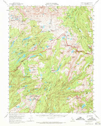
1956 Map of Tower Peak
USGS Topo · Published 1972About this map
Stanislaus National Forest, Toiyabe National Forest, and Yosemite National Park converge in this high-altitude landscape dominated by the peaks of the Sierra Nevada. The map captures a transition in alpine resource use during the mid-1950s, where mining history at the Montezuma Mine sits alongside early conservation and recreation infrastructure. High-altitude meadows like Emigrant Meadow and Lunch Meadow provide historical context for the movement of people through the granite passes, while Piute Cabin suggests a quiet human footprint in the backcountry. A network of glacial lakes, including Middle Emigrant Lake, Dorothy Lake, and Mary Lake, defines the hydrology of the High Sierra before modern water management further altered the downstream valleys. This survey documents the crest of the range from Relief Peak to the massive Tower Peak, illustrating the complex terrain of the Mono and Tuolumne County line.
Find a feature on this map
140 named features on this map. Tap any name to fly to it.
Don’t see what you’re looking for? This feature index may not catch every label — zoom into the map to look around manually.
Map Details
Editions of this 1956 Tower Peak Map
4 editions found
Other maps of this area

1896 · Dardanelles
USGS Topo · 1:125,000

1897 · Yosemite
USGS Topo · 1:125,000

1898 · Dardanelles
USGS Topo · 1:125,000

1900 · Yosemite
USGS Topo · 1:125,000

1901 · Mt. Lyell
USGS Topo · 1:125,000

1903 · Yosemite
USGS Topo · 1:125,000

1909 · Yosemite
USGS Topo · 1:125,000

1909 · Bridgeport
USGS Topo · 1:125,000

1911 · Bridgeport
USGS Topo · 1:125,000

1920 · Bridgeport
USGS Topo · 1:125,000