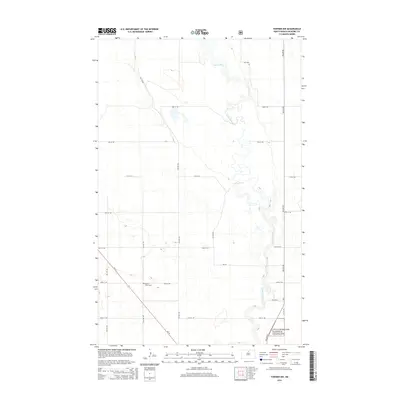
2014 Map of Towner NW
USGS Topo · Published 2014About this map
The meandering course of the Souris River dominates this portion of McHenry County, carving a serpentine path through the North Dakota landscape. This 2014 survey reveals a region defined by agricultural grid lines and quiet rural landmarks, most notably the Mouse River Cem situated along 68th St NE west of 5th Ave NE. The intricate loops and oxbows of the river contrast sharply with the rigid network of section roads like Willow Rd and 73rd St NE. In the southeastern corner, the map indicates a portion of the Little Missouri National Grassland, reflecting federal land management in this prairie environment. Transportation is anchored by ND-14, which cuts diagonally across the southwestern section, providing a primary link through the sprawling farm and rangeland.
Find a feature on this map
21 named features on this map. Tap any name to fly to it.
Don’t see what you’re looking for? This feature index may not catch every label — zoom into the map to look around manually.
Map Details
Editions of this 2014 Towner NW Map
This is the sole edition of this map. No revisions or reprints were ever made.
Other maps of this area

1949 · Denbigh
USGS Topo · 1:24,000

1949 · Bantry
USGS Topo · 1:24,000

1950 · Towner NW
USGS Topo · 1:24,000

1950 · Upham SE
USGS Topo · 1:24,000

1950 · Towner
USGS Topo · 1:24,000

1950 · Willow City SW
USGS Topo · 1:24,000

1950 · Denbigh
USGS Topo · 1:24,000

1950 · Bantry
USGS Topo · 1:24,000

1954 · Towner NE
USGS Topo · 1:24,000

1954 · Willow City
USGS Topo · 1:24,000