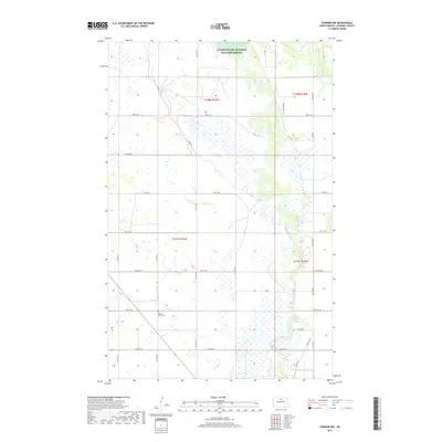
2017 Map of Towner NW
USGS Topo · Published 2017About this map
The Souris River meanders through this portion of McHenry County, defining a landscape of riparian wetlands and prairie uplands. A significant portion of the northern terrain is occupied by the J Clark Salyer National Wildlife Refuge, established to protect the migratory bird habitat along this winding waterway. The map reflects a structured section-line road network typical of the Great Plains, where routes like 73rd St NE and Willow Hwy provide access to the dispersed agricultural lands. Local history is anchored by the Mouse River Cem located near the center of the sheet, providing a primary point of interest for genealogists tracing early families in the region. The proximity of RR Rd to the river's edge suggests the historical importance of the valley for both transportation and early settlement patterns.
Find a feature on this map
17 named features on this map. Tap any name to fly to it.
Don’t see what you’re looking for? This feature index may not catch every label — zoom into the map to look around manually.
Map Details
Editions of this 2017 Towner NW Map
This is the sole edition of this map. No revisions or reprints were ever made.
Other maps of this area

1949 · Denbigh
USGS Topo · 1:24,000

1949 · Bantry
USGS Topo · 1:24,000

1950 · Towner NW
USGS Topo · 1:24,000

1950 · Upham SE
USGS Topo · 1:24,000

1950 · Towner
USGS Topo · 1:24,000

1950 · Willow City SW
USGS Topo · 1:24,000

1950 · Denbigh
USGS Topo · 1:24,000

1950 · Bantry
USGS Topo · 1:24,000

1954 · Towner NE
USGS Topo · 1:24,000

1954 · Willow City
USGS Topo · 1:24,000