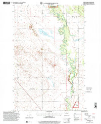
1997 Map of Towner NW
USGS Topo · Published 2001About this map
The Souris River meanders dramatically across this McHenry County landscape, its tight oxbows and marshy banks creating a complex riparian environment. This 1997 revision captures a rural district defined by wide-open plains and the conservation boundaries of the Clark Salyer National Wildlife Refuge in the north and the Custer Nat Forest in the south. The human footprint is marked by the distribution of country schoolhouses, which served as vital community hubs for the scattered farmsteads of the region. Notable landmarks including Poplar Grove Sch No 1, Mouse River Sch No 1, and Red Cross Sch No 1 provide precise anchor points for local historians and genealogists tracing family ties to these prairie townships.
Find a feature on this map
7 named features on this map. Tap any name to fly to it.
Don’t see what you’re looking for? This feature index may not catch every label — zoom into the map to look around manually.
Map Details
Editions of this 1997 Towner NW Map
This is the sole edition of this map. No revisions or reprints were ever made.
Other maps of this area

1949 · Denbigh
USGS Topo · 1:24,000

1949 · Bantry
USGS Topo · 1:24,000

1950 · Towner NW
USGS Topo · 1:24,000

1950 · Upham SE
USGS Topo · 1:24,000

1950 · Towner
USGS Topo · 1:24,000

1950 · Willow City SW
USGS Topo · 1:24,000

1950 · Denbigh
USGS Topo · 1:24,000

1950 · Bantry
USGS Topo · 1:24,000

1954 · Towner NE
USGS Topo · 1:24,000

1954 · Willow City
USGS Topo · 1:24,000