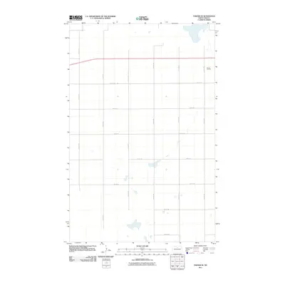
2011 Map of Towner SE
USGS Topo · Published 2011About this map
The Berwick Cemetery stands as a primary historical landmark in this corner of McHenry County, situated near the northeastern edge of the quadrangle. The landscape is defined by the strict cardinal grid of the Public Land Survey System, with roads like 10th Ave Ne and 64th St Ne marking the section lines across the prairie. This 2011 survey by the U.S. Geological Survey details a rural North Dakota environment where seasonal water bodies and small depressions are scattered among the fields. The infrastructure is primarily agricultural, connected by a network of local routes including 12th Ave Ne and 58th St Ne, which facilitate movement across the vast, open acreage of the northern plains.
Find a feature on this map
14 named features on this map. Tap any name to fly to it.
Don’t see what you’re looking for? This feature index may not catch every label — zoom into the map to look around manually.
Map Details
Editions of this 2011 Towner SE Map
This is the sole edition of this map. No revisions or reprints were ever made.
Other maps of this area

1950 · Towner NW
USGS Topo · 1:24,000

1950 · Towner
USGS Topo · 1:24,000

1954 · Towner NE
USGS Topo · 1:24,000

1954 · Berwick
USGS Topo · 1:24,000

1954 · Round Lake
USGS Topo · 1:24,000

1954 · Towner SE
USGS Topo · 1:24,000

1954 · Minot
USGS Topo · 1:250,000

1955 · Rangeley NW
USGS Topo · 1:24,000

1955 · Rangeley NE
USGS Topo · 1:24,000

1958 · Minot
USGS Topo · 1:250,000