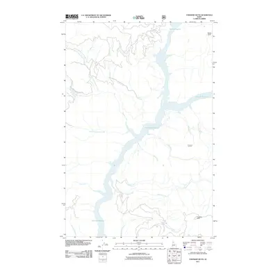
2011 Map of Township Butte
USGS Topo · Published 2011About this map
Dworshak Reservoir dominates the drainage patterns of this Clearwater County landscape, where various forks of Robinson Creek and Long Creek converge within its branching shoreline. The terrain is defined by high points such as Township Butte and Boehls Butte, reflecting the deep valleys and ridges of the North Fork Clearwater River region. Historical land use and navigation in this timber-rich area are evidenced by the Diamond Match Camp Rd in the west and the Armstrong Lookout situated on a high ridge overlooking McIntyre Creek. Numerous smaller tributaries including Gyppo Creek, Elkberry Creek, and Little Silver Creek feed into the primary reservoir system, illustrating the complex hydrology of the Idaho interior. This 2011 survey captures the state of the reservoir and forest access roads long after the completion of the Dworshak Dam project downstream.
Find a feature on this map
19 named features on this map. Tap any name to fly to it.
Don’t see what you’re looking for? This feature index may not catch every label — zoom into the map to look around manually.
Map Details
Editions of this 2011 Township Butte Map
This is the sole edition of this map. No revisions or reprints were ever made.
Other maps of this area

1923 · Washington Creek
USGS Topo · 1:125,000

1936 · Boehls Butte
USGS Topo · 1:48,000

1938 · Headquarters
USGS Topo · 1:48,000

1943 · Boehls Butte
USGS Topo · 1:62,500

1944 · Headquarters
USGS Topo · 1:62,500

1955 · Pullman
USGS Topo · 1:250,000

1956 · Hamilton
USGS Topo · 1:250,000

1958 · Pullman
USGS Topo · 1:250,000

1959 · Hamilton
USGS Topo · 1:250,000

1960 · Hamilton
USGS Topo · 1:250,000