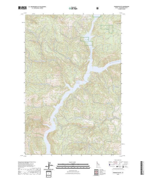
2024 Map of Township Butte
USGS Topo · Published 2024About this map
Dworshak Reservoir dominates the central topography of this Clearwater County landscape, where the inundated canyon of the Little North Fork Clearwater River meets the larger North Fork Clearwater River. The terrain is defined by significant elevations such as Township Butte and Boehls Butte, situated within the boundaries of the St. Joe National Forest. The map documents a network of remote access routes including Burma Rd, Aquarius Rd, and Grandad Rd, which wind through the complex drainage basins of Robinson Creek and its many forks. A specific site of interest for local history is Old Camp T, located near the headwaters of Elkberry Creek, reflecting the area's history of backcountry camps and forest management. The numerous named watercourses, such as Little Meadow Creek and Gyppo Creek, illustrate the intricate watershed that feeds the reservoir system.
Find a feature on this map
32 named features on this map. Tap any name to fly to it.
Don’t see what you’re looking for? This feature index may not catch every label — zoom into the map to look around manually.
Map Details
Editions of this 2024 Township Butte Map
This is the sole edition of this map. No revisions or reprints were ever made.
Other maps of this area

1923 · Washington Creek
USGS Topo · 1:125,000

1936 · Boehls Butte
USGS Topo · 1:48,000

1938 · Headquarters
USGS Topo · 1:48,000

1943 · Boehls Butte
USGS Topo · 1:62,500

1944 · Headquarters
USGS Topo · 1:62,500

1955 · Pullman
USGS Topo · 1:250,000

1956 · Hamilton
USGS Topo · 1:250,000

1958 · Pullman
USGS Topo · 1:250,000

1959 · Hamilton
USGS Topo · 1:250,000

1960 · Hamilton
USGS Topo · 1:250,000