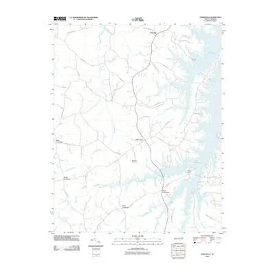
2010 Map of Townsville
USGS Topo · Published 2010About this map
Townsville and the surrounding Vance County landscape are defined by the expansive waters of the John H Kerr Reservoir, which dominates the eastern half of this terrain. The map reveals a network of rural settlements linked by historic thoroughfares like Stagecoach Rd and names that hint at the region's industrial past, such as Tungsten Mine Rd. In this corner of North Carolina, the community centers are often marked by crossroads, including Knotts Crossroads, Kellys Crossroads, and Hicks Crossroads. Near the reservoir, recreational and local transport hubs like Townsville Landing and the Nutbush Bridge Campground sit alongside Little Nutbush Creek. The interior is crisscrossed by several waterways, including Little Island Creek and Flat Creek, which shaped the early settlement patterns of old Williamsboro.
Find a feature on this map
50 named features on this map. Tap any name to fly to it.
Don’t see what you’re looking for? This feature index may not catch every label — zoom into the map to look around manually.
Map Details
Editions of this 2010 Townsville Map
This is the sole edition of this map. No revisions or reprints were ever made.
Other maps of this area

1941 · Clarksville
USGS Topo · 1:48,000

1943 · Clarksville
USGS Topo · 1:62,500

1953 · Oxford
USGS Topo · 1:62,500

1953 · Greensboro
USGS Topo · 1:250,000

1954 · Greensboro
USGS Topo · 1:250,000

1955 · Boydton
USGS Topo · 1:62,500

1957 · Clarksville
USGS Topo · 1:62,500

1962 · Greensboro
USGS Topo · 1:250,000

1966 · Greensboro
USGS Topo · 1:250,000

1966 · Oxford
USGS Topo · 1:62,500
Featured Places
- Knotts Crossroads, NC
- Harris Crossroads, NC
- Island Creek Estates, NC
- Townsville, NC
- Kellys Crossroads, NC