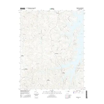
2016 Map of Townsville
USGS Topo · Published 2016About this map
John H. Kerr Reservoir dominates the eastern edge of this Vance County landscape, where the irregular shoreline creates numerous inlets and peninsulas such as those near Taylors Pointe Ln. The terrain is defined by a network of crossroads settlements that served as local hubs for the surrounding rural tracts. Townsville and Williamsboro anchor the central corridor, while smaller junctions like Knotts Crossroads and Hicks Crossroads mark the western reaches. A legacy of local industry is preserved in road names like Tungsten Mine Rd near the northern border. Drainage into the reservoir is provided by various smaller watercourses, including Little Nutbush Cr and Poplar Spring Br, which carve gentle valleys through the wooded and agricultural plots between the historic road alignments.
Find a feature on this map
83 named features on this map. Tap any name to fly to it.
Don’t see what you’re looking for? This feature index may not catch every label — zoom into the map to look around manually.
Map Details
Editions of this 2016 Townsville Map
This is the sole edition of this map. No revisions or reprints were ever made.
Other maps of this area

1941 · Clarksville
USGS Topo · 1:48,000

1943 · Clarksville
USGS Topo · 1:62,500

1953 · Oxford
USGS Topo · 1:62,500

1953 · Greensboro
USGS Topo · 1:250,000

1954 · Greensboro
USGS Topo · 1:250,000

1955 · Boydton
USGS Topo · 1:62,500

1957 · Clarksville
USGS Topo · 1:62,500

1962 · Greensboro
USGS Topo · 1:250,000

1966 · Greensboro
USGS Topo · 1:250,000

1966 · Oxford
USGS Topo · 1:62,500
Featured Places
- Knotts Crossroads, NC
- Harris Crossroads, NC
- Island Creek Estates, NC
- Townsville, NC
- Kellys Crossroads, NC