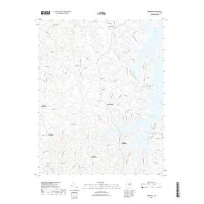
2019 Map of Townsville
USGS Topo · Published 2019About this map
The community of Townsville and its surrounding countryside in Vance County are defined by their proximity to the western reaches of the John H. Kerr Reservoir. The landscape is a network of rural hubs, including Williamsboro, Knotts Crossroads, and Hicks Crossroads, connected by roads that hint at the region's industrial past, such as Tungsten Mine Rd. These small settlements are situated among a dense drainage system that feeds into the reservoir, with notable water bodies like Little Nuthush Cr and Nuthush Cr shaping the local topography.
Find a feature on this map
86 named features on this map. Tap any name to fly to it.
Don’t see what you’re looking for? This feature index may not catch every label — zoom into the map to look around manually.
Map Details
Editions of this 2019 Townsville Map
This is the sole edition of this map. No revisions or reprints were ever made.
Other maps of this area

1941 · Clarksville
USGS Topo · 1:48,000

1943 · Clarksville
USGS Topo · 1:62,500

1953 · Oxford
USGS Topo · 1:62,500

1953 · Greensboro
USGS Topo · 1:250,000

1954 · Greensboro
USGS Topo · 1:250,000

1955 · Boydton
USGS Topo · 1:62,500

1957 · Clarksville
USGS Topo · 1:62,500

1962 · Greensboro
USGS Topo · 1:250,000

1966 · Greensboro
USGS Topo · 1:250,000

1966 · Oxford
USGS Topo · 1:62,500
Featured Places
- Knotts Crossroads, NC
- Harris Crossroads, NC
- Island Creek Estates, NC
- Townsville, NC
- Kellys Crossroads, NC