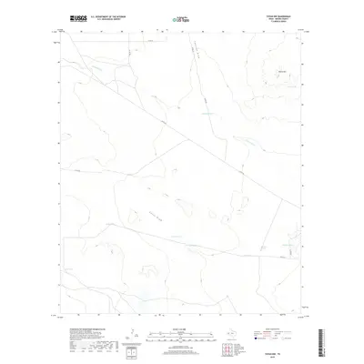
2019 Map of Toyah NW
USGS Topo · Published 2019About this map
China Draw and Coalson Draw cut through this arid landscape of Reeves County, defining a territory where water management is central to the land's utility. The presence of numerous named water sources, such as Canyon Spring, Twin Spring, and Johnson Spring, suggests the critical importance of these specific locations for livestock and local survival in the Trans-Pecos region.
Find a feature on this map
17 named features on this map. Tap any name to fly to it.
Don’t see what you’re looking for? This feature index may not catch every label — zoom into the map to look around manually.
Map Details
Editions of this 2019 Toyah NW Map
This is the sole edition of this map. No revisions or reprints were ever made.
Other maps of this area

1921 · Toyah
USGS Topo · 1:125,000

1928 · Kent
USGS Topo · 1:125,000

1954 · Van Horn
USGS Topo · 1:250,000

1954 · Pecos
USGS Topo · 1:250,000

1957 · Pecos
USGS Topo · 1:250,000

1958 · Van Horn
USGS Topo · 1:250,000

1968 · W T Ranch
USGS Topo · 1:24,000
1968 · Halamicek Ranch
USGS Topo · 1:24,000

1970 · Big Hill
USGS Topo · 1:24,000

1970 · Toyah
USGS Topo · 1:24,000