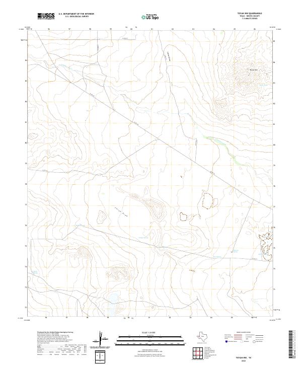
2022 Map of Toyah NW
USGS Topo · Published 2022About this map
China Draw and Coalison Draw define the drainage patterns of this Reeves County landscape, where water sources are vital landmarks in an arid environment. The map shows a collection of named water features including Canyon Spring, Burnt Spring, and Twin Spring, which historically served as essential points for livestock and travelers. Near the eastern edge, Johnson Lake and Johnson Spring provide evidence of named land use, likely connected to local ranching history. The terrain is marked by Round Mtn in the northeast, rising above Rock Tank. A network of county roads, such as Co RD 222 and Co RD 231, connects these remote sites, tracing the movement across a region defined more by its draws and springs than by formal settlements.
Find a feature on this map
17 named features on this map. Tap any name to fly to it.
Don’t see what you’re looking for? This feature index may not catch every label — zoom into the map to look around manually.
Map Details
Editions of this 2022 Toyah NW Map
This is the sole edition of this map. No revisions or reprints were ever made.
Other maps of this area

1921 · Toyah
USGS Topo · 1:125,000

1928 · Kent
USGS Topo · 1:125,000

1954 · Van Horn
USGS Topo · 1:250,000

1954 · Pecos
USGS Topo · 1:250,000

1957 · Pecos
USGS Topo · 1:250,000

1958 · Van Horn
USGS Topo · 1:250,000

1968 · W T Ranch
USGS Topo · 1:24,000
1968 · Halamicek Ranch
USGS Topo · 1:24,000

1970 · Big Hill
USGS Topo · 1:24,000

1970 · Toyah
USGS Topo · 1:24,000