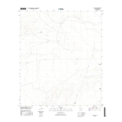
2016 Map of Toyah SW
USGS Topo · Published 2016About this map
Pelican Spring and Coyote Spring anchor this arid Trans-Pecos landscape in Reeves County, where the desert topography is defined by seasonal watercourses and ancient springs. The terrain is crisscrossed by several significant drainages, including the wide Salt Draw in the north and San Martine Draw to the east. These ephemeral features are critical markers in the West Texas cattle country, as evidenced by man-made infrastructure like Jog Tank. The presence of an Oil Field in the eastern section of the map highlights the area's industrial importance, as resource extraction follows the natural contours of the land. Local travel is facilitated by rural routes such as Co RD 225 and Co RD 229, providing access to this sparsely populated expanse of the Permian Basin.
Find a feature on this map
12 named features on this map. Tap any name to fly to it.
Don’t see what you’re looking for? This feature index may not catch every label — zoom into the map to look around manually.
Map Details
Editions of this 2016 Toyah SW Map
This is the sole edition of this map. No revisions or reprints were ever made.
Other maps of this area

1921 · Toyah
USGS Topo · 1:125,000

1928 · Kent
USGS Topo · 1:125,000

1954 · Van Horn
USGS Topo · 1:250,000

1954 · Pecos
USGS Topo · 1:250,000

1957 · Pecos
USGS Topo · 1:250,000

1958 · Van Horn
USGS Topo · 1:250,000

1970 · Florenzo Hill
USGS Topo · 1:24,000

1970 · Big Hill
USGS Topo · 1:24,000

1970 · Toyah
USGS Topo · 1:24,000
1970 · San Martine
USGS Topo · 1:24,000