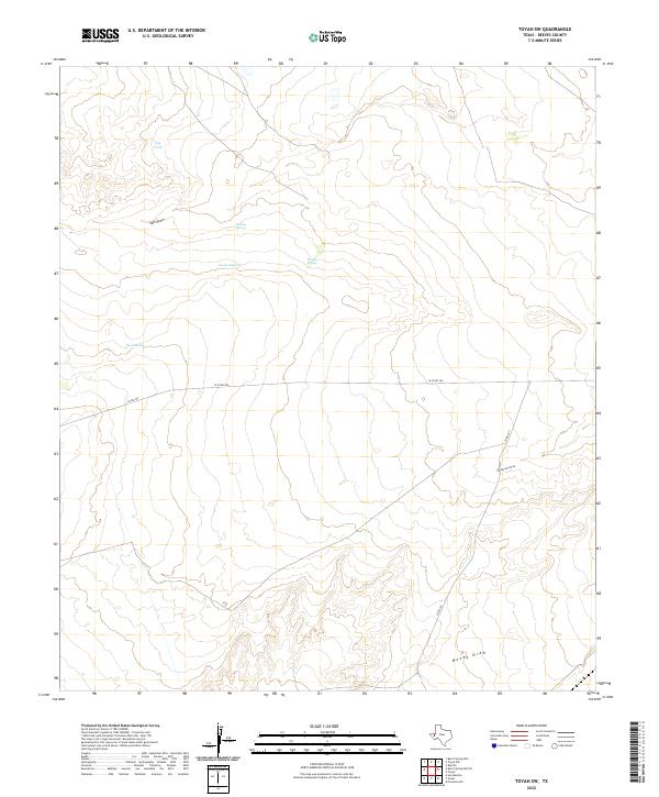
2022 Map of Toyah SW
USGS Topo · Published 2022About this map
Pelican Spring and Coyote Spring anchor this section of Reeves County, serving as vital water points in an arid Trans-Pecos environment. The landscape is defined by its drainage patterns, notably the winding Salt Draw which moves across the upper elevations near Jog Tank. The terrain consists of subtle ridges and flats where seasonal runoff is channeled through features like San Martine Draw and Moody Draw. Human imprint is sparse, limited primarily to the straight-line paths of W Co Rd 225 and Co Rd 229, which facilitate movement between these isolated watering holes and grazing lands. This survey provides a precise look at the ranching infrastructure and natural hydrology that dictates the use of this West Texas territory.
Find a feature on this map
9 named features on this map. Tap any name to fly to it.
Don’t see what you’re looking for? This feature index may not catch every label — zoom into the map to look around manually.
Map Details
Editions of this 2022 Toyah SW Map
This is the sole edition of this map. No revisions or reprints were ever made.
Other maps of this area

1921 · Toyah
USGS Topo · 1:125,000

1928 · Kent
USGS Topo · 1:125,000

1954 · Van Horn
USGS Topo · 1:250,000

1954 · Pecos
USGS Topo · 1:250,000

1957 · Pecos
USGS Topo · 1:250,000

1958 · Van Horn
USGS Topo · 1:250,000

1970 · Florenzo Hill
USGS Topo · 1:24,000

1970 · Big Hill
USGS Topo · 1:24,000

1970 · Toyah
USGS Topo · 1:24,000
1970 · San Martine
USGS Topo · 1:24,000