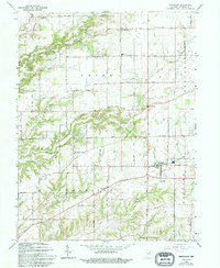
1965 Map of Trafalgar
USGS Topo · Published 1994About this map
Trafalgar serves as the central hub of this Johnson County landscape, where the intersection of state routes meets the remnants of an Old RR Grade. The settlement pattern reflects a mid-20th-century rural economy, with small communities like Samaria, Anita, and Bud dispersed among a network of numbered section roads. The terrain is defined by the drainage of Stotts Creek and its various branches, including Prong Stotts Creek and South Fork Stotts Creek. Notable landmarks include the Radio Tower (WTTV-TV) and several local gathering places such as Christian Chapel and Beech Grove Ch. For genealogists, the map is a detailed record of local burial sites, preserving the locations of Shiloh Cem, Harris Cem, and Carmen Cem amidst the agricultural fields of Union and Hensley townships.
Find a feature on this map
53 named features on this map. Tap any name to fly to it.
Don’t see what you’re looking for? This feature index may not catch every label — zoom into the map to look around manually.
Map Details
Editions of this 1965 Trafalgar Map
4 editions found
Other maps of this area

1942 · Franklin
USGS Topo · 1:125,000

1947 · Franklin
USGS Topo · 1:62,500

1948 · Franklin
USGS Topo · 1:24,000

1948 · Trafalgar
USGS Topo · 1:24,000

1948 · Nineveh
USGS Topo · 1:24,000

1948 · Fruitdale
USGS Topo · 1:24,000

1948 · Morgantown
USGS Topo · 1:24,000

1950 · Morgantown
USGS Topo · 1:24,000

1950 · Franklin
USGS Topo · 1:62,500

1952 · Bargersville
USGS Topo · 1:24,000