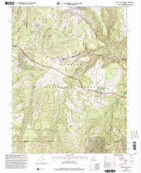
2001 Map of Trail Mountain
USGS Topo · Published 2003About this map
Fishlake National Forest encompasses this high-elevation landscape, where the waters of Three Creeks Reservoir and Three Creeks dominate the northern terrain. The map captures a rugged intersection of drainage systems and ridge lines at the turn of the 21st century, centered on the prominent Trail Mountain and the steep descent of Clear Creek Canyon. Land use here is defined by resource management and natural features, evidenced by the presence of a Quarry and Gravel Pits near the southern boundary between Sevier and Piute counties.
Find a feature on this map
35 named features on this map. Tap any name to fly to it.
Don’t see what you’re looking for? This feature index may not catch every label — zoom into the map to look around manually.
Map Details
Editions of this 2001 Trail Mountain Map
This is the sole edition of this map. No revisions or reprints were ever made.
Other maps of this area

1885 · Beaver
USGS Topo · 1:250,000

1932 · Sevier
USGS Topo · 1:62,500

1935 · Sevier
USGS Topo · 1:62,500

1937 · Delano Peak
USGS Topo · 1:48,000

1943 · Delano Peak
USGS Topo · 1:62,500

1953 · Richfield
USGS Topo · 1:250,000

1954 · Beaver NE
USGS Topo · 1:24,000

1958 · Richfield
USGS Topo · 1:250,000

1958 · Beaver
USGS Topo · 1:62,500

1962 · Cove Fort
USGS Topo · 1:62,500