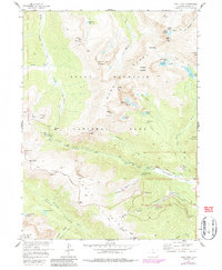
1957 Map of Trail Ridge
USGS Topo · Published 1986About this map
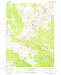
Rocky Mountain National Park contains some of the highest alpine environments in the country, centered here on the Mummy Range and the high-altitude route of Trail Ridge Road. This mid-century survey illustrates the engineering of the high country, from the hairpin turns of Tundra Curves and the Rainbow Curve to the historic Fall River Road. High peaks like Hagues Peak and Fairchild Mountain dominate the landscape, while the Rowe Glacier sits near the northern boundary.
Find a feature on this map
66 named features on this map. Tap any name to fly to it.
Don’t see what you’re looking for? This feature index may not catch every label — zoom into the map to look around manually.
Map Details
Editions of this 1957 Trail Ridge Map
8 editions found
Other maps of this area

1915 · Longs Peak
USGS Topo · 1:125,000

1916 · Home
USGS Topo · 1:125,000

1919 · Rocky Mountain National Park
USGS Topo · 1:125,000

1920 · Home
USGS Topo · 1:125,000

1954 · Greeley
USGS Topo · 1:250,000

1957 · Greeley
USGS Topo · 1:250,000

1957 · Mc Henrys Peak
USGS Topo · 1:24,000

1957 · Trail Ridge
USGS Topo · 1:24,000

1957 · Longs Peak
USGS Topo · 1:24,000

1957 · Estes Park
USGS Topo · 1:24,000