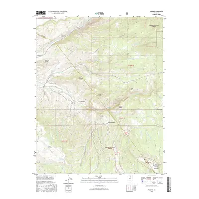
2017 Map of Trampas
USGS Topo · Published 2017About this map
Rio Grande waters carve through the northwest corner of this landscape, marking the rugged boundary between Taos and Rio Arriba counties. High-altitude settlements like Trampas and Chamisal are situated along the winding drainage of the Rio de las Trampas, where life is oriented around narrow valleys and traditional water systems like El Llano Ditch. This 2017 survey shows the intricate network of mountain peaks and canyons within the Carson National Forest, including the prominent Cerro Puntiagudo and Copper Hill. For those tracing local heritage, the map identifies specific landmarks such as the San Jose de Gracia Cem and the Las Trampas Cem. The terrain is defined by numerous cañadas, such as Cañada de Ojo Sarco and Cañada de Piedra Lumbre, which channel runoff from the high ridges toward Embudo Creek.
Find a feature on this map
52 named features on this map. Tap any name to fly to it.
Don’t see what you’re looking for? This feature index may not catch every label — zoom into the map to look around manually.
Map Details
Editions of this 2017 Trampas Map
This is the sole edition of this map. No revisions or reprints were ever made.
Other maps of this area

1953 · Truchas
USGS Topo · 1:24,000

1953 · Velarde
USGS Topo · 1:24,000

1953 · Trampas
USGS Topo · 1:24,000

1953 · Chimayo
USGS Topo · 1:24,000

1954 · Raton
USGS Topo · 1:250,000

1958 · Raton
USGS Topo · 1:250,000

1960 · Taos Junction
USGS Topo · 1:24,000

1961 · Carson
USGS Topo · 1:24,000

1964 · Penasco
USGS Topo · 1:24,000

1964 · Taos SW
USGS Topo · 1:24,000