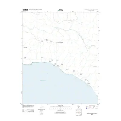
2012 Map of Tranquillon Mountain
USGS Topo · Published 2012About this map
Tranquillon Mountain and the coastal ridges of Santa Barbara County define this landscape where the mountains meet the Pacific Ocean. This coastal stretch is marked by numerous deep drainages, including Cañada Honda Cr and San Miguelito Cr, which carve through the uplifted terrain of Cypress Ridge and Tranquillon Ridge. The topography reflects a history of coastal access and early resource extraction, notably at Oil Well Canyon.
Find a feature on this map
28 named features on this map. Tap any name to fly to it.
Don’t see what you’re looking for? This feature index may not catch every label — zoom into the map to look around manually.
Map Details
Editions of this 2012 Tranquillon Mountain Map
This is the sole edition of this map. No revisions or reprints were ever made.
Other maps of this area

1905 · Guadalupe
USGS Topo · 1:125,000

1905 · Lompoc
USGS Topo · 1:125,000

1942 · Point Arguello
USGS Topo · 1:62,500

1942 · Guadalupe
USGS Topo · 1:125,000

1942 · Lompoc
USGS Topo · 1:125,000

1942 · Lompoc
USGS Topo · 1:62,500

1942 · Pt. Conception
USGS Topo · 1:62,500

1943 · Lompoc
USGS Topo · 1:125,000

1947 · Lompoc
USGS Topo · 1:24,000

1947 · Surf
USGS Topo · 1:24,000