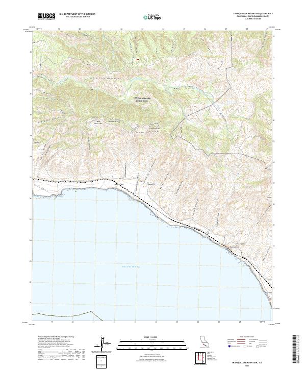
2021 Map of Tranquillon Mountain
USGS Topo · Published 2021About this map
Tranquillon Mtn stands as a prominent landmark within the Santa Ynez Mountains, overlooking a shoreline where the land drops away at Espada Bluff into the Pacific Ocean. This coastal landscape is defined by its series of deep canyons and seasonal drainages, including Cañada Honda Cr and Sudden Canyon, which cut through the high ridges. Pockets of flat terrain such as Wild Horse Flat and Sudden Flats provide rare level ground amidst the steep elevation of Wild Horse Peak and Tranquillon Ridge. The map shows a network of ridge-top roads like Honda Ridge Rd and coastal routes such as Coast Rd, which navigate the complex topography. The interior is largely characterized by traditional land divisions and remote watersheds like Cañada De Los Sauces, reflecting a landscape preserved from heavy urbanization.
Find a feature on this map
54 named features on this map. Tap any name to fly to it.
Don’t see what you’re looking for? This feature index may not catch every label — zoom into the map to look around manually.
Map Details
Editions of this 2021 Tranquillon Mountain Map
This is the sole edition of this map. No revisions or reprints were ever made.
Other maps of this area

1905 · Guadalupe
USGS Topo · 1:125,000

1905 · Lompoc
USGS Topo · 1:125,000

1942 · Point Arguello
USGS Topo · 1:62,500

1942 · Guadalupe
USGS Topo · 1:125,000

1942 · Lompoc
USGS Topo · 1:125,000

1942 · Lompoc
USGS Topo · 1:62,500

1942 · Pt. Conception
USGS Topo · 1:62,500

1943 · Lompoc
USGS Topo · 1:125,000

1947 · Lompoc
USGS Topo · 1:24,000

1947 · Surf
USGS Topo · 1:24,000