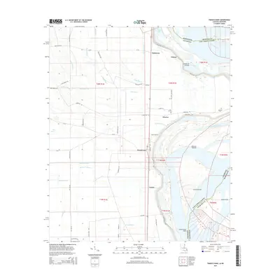
2015 Map of Transylvania
USGS Topo · Published 2015About this map
Mississippi River floodplains in East Carroll Parish define this landscape, where the shifting river channel and an intricate drainage network of bayous shape the settlement patterns. Small communities like Transylvania and Atherton are situated along the primary north-south corridors, such as the Transylvania Loop, while the land to the east is dominated by river features including Transylvania Chute and the broad Alsatia-Salem Bend. Evidence of the river's power is recorded in names like Hollybrook Crevasse, a reminder of past levee breaches. Local history and genealogy interest is concentrated at sites like Cold Tar Cem and Benjamin Cem, while the western terrain is a web of agricultural drainage ditches and aptly named water bodies such as Duckpond Bayou and Graveyard Bayou.
Find a feature on this map
66 named features on this map. Tap any name to fly to it.
Don’t see what you’re looking for? This feature index may not catch every label — zoom into the map to look around manually.
Map Details
Editions of this 2015 Transylvania Map
This is the sole edition of this map. No revisions or reprints were ever made.
Other maps of this area

1909 · Baxter Bayou
USGS Topo · 1:24,000

1909 · Lake Providence
USGS Topo · 1:24,000

1911 · Lake Providence
USGS Topo · 1:31,680

1911 · Baxter Bayou
USGS Topo · 1:24,000

1914 · Baxter Bayou
USGS Topo · 1:31,680

1935 · Oak Grove
USGS Topo · 1:62,500

1939 · Alsatia
USGS Topo · 1:62,500

1939 · Mayersville
USGS Topo · 1:62,500

1955 · Jackson
USGS Topo · 1:250,000

1958 · Oak Grove
USGS Topo · 1:62,500