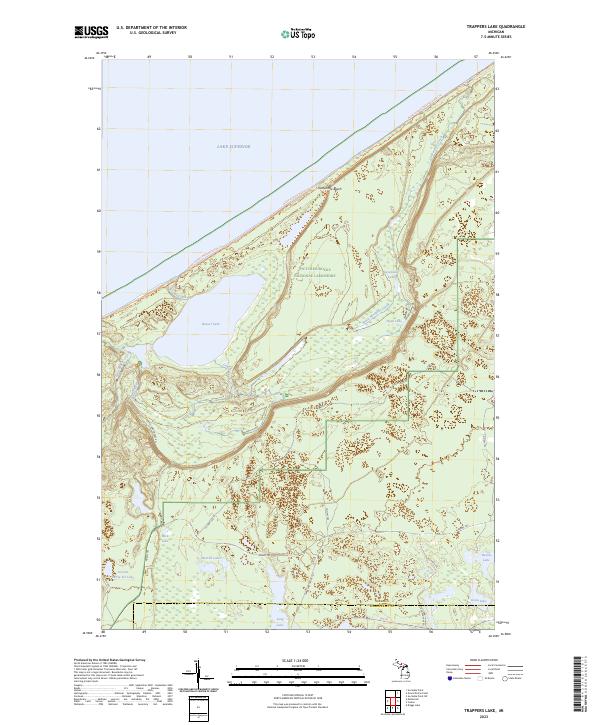
2023 Map of Trappers Lake
USGS Topo · Published 2023About this map
Pictured Rocks National Lakeshore dominates this Upper Peninsula landscape, where the waters of Lake Superior meet the northern coastline of Michigan. The map highlights the extensive Beaver Basin Wilderness, a protected area defined by its complex hydrology and dense forest cover. Numerous inland water bodies, such as the large Beaver Lake and the smaller Sevenmile Lake, are fed by a network of drainage systems including Black Mosquito Creek and Sevenmile Creek.
Find a feature on this map
36 named features on this map. Tap any name to fly to it.
Don’t see what you’re looking for? This feature index may not catch every label — zoom into the map to look around manually.
Map Details
Editions of this 2023 Trappers Lake Map
This is the sole edition of this map. No revisions or reprints were ever made.
Other maps of this area

1931 · Shingleton NE
USGS Topo · 1:31,680

1931 · Driggs Lake NW
USGS Topo · 1:31,680

1958 · Shingleton
USGS Topo · 1:62,500

1958 · Grand Portal Point
USGS Topo · 1:62,500

1958 · Marquette
USGS Topo · 1:250,000

1960 · Marquette
USGS Topo · 1:250,000

1961 · Marquette
USGS Topo · 1:250,000
1966 · Au Sable Point
USGS Topo · 1:24,000
1966 · Au Sable Point SW
USGS Topo · 1:24,000

1968 · Marquette
USGS Topo · 1:250,000