
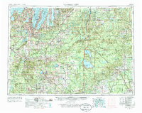
1989 Map of Traverse City
USGS Topo · Published 1990This historical map portrays the area of Traverse City in 1989, primarily covering Grand Traverse County as well as portions of Missaukee County, Arenac County, Crawford County, Lake County, Wexford County, Clare County, Montmorency County, Oscoda County, Gladwin County, Otsego County, Manistee County, Roscommon County, Antrim County, Osceola County, Leelanau County, Ogemaw County, Benzie County, and Kalkaska County. Featuring a scale of 1:250000, this map provides a highly detailed snapshot of the terrain, roads, buildings, counties, and historical landmarks in the Traverse City region at the time. Published in 1990, it is the sole known edition of this map.
Find a feature on this map
135 named features on this map. Tap any name to fly to it.
Don’t see what you’re looking for? This feature index may not catch every label — zoom into the map to look around manually.
Map Details
Editions of this 1989 Traverse City Map
This is the sole edition of this map. No revisions or reprints were ever made.
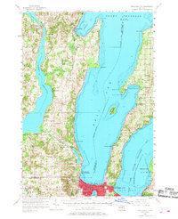
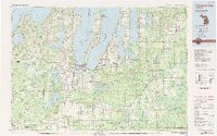
Historical Maps of Bellaire Through Time
5 maps found

Featured Locations
- East Bay Township, MI
- Garfield Township, MI
- Traverse City, MI
- East Bay Charter Township, East Bay Township
- Garfield Charter Township, Garfield Township