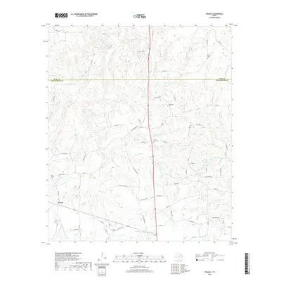
2019 Map of Trawick
USGS Topo · Published 2019About this map
Trawick and Caro sit within a landscape defined by the drainage networks of the E Fork Pen Cr and the W Fork Pen Cr. The area is marked by numerous family-named landmarks and historical burial grounds, including the Hall Springs Cem and Linn Flat Cem near Trawick, and the Helpenstell Cem further east. The terrain is a complex of small creek branches such as Gentry Br and Seelbach Br, interspersed with small water bodies like Jackson Lake and Barnes Lake. The Rusk and Nacogdoches county line bisects the northern third of the map, while local transportation is anchored by the Old Henderson Hwy and the historical Old Tyler Rd, reflecting the established rural infrastructure of this East Texas region.
Find a feature on this map
93 named features on this map. Tap any name to fly to it.
Don’t see what you’re looking for? This feature index may not catch every label — zoom into the map to look around manually.
Map Details
Editions of this 2019 Trawick Map
This is the sole edition of this map. No revisions or reprints were ever made.
Other maps of this area

1943 · Cushing
USGS Topo · 1:62,500

1945 · Cushing
USGS Topo · 1:62,500

1952 · Douglass
USGS Topo · 1:62,500

1952 · Nacogdoches
USGS Topo · 1:62,500

1953 · Palestine
USGS Topo · 1:250,000

1957 · Palestine
USGS Topo · 1:250,000

1960 · Mount Enterprise
USGS Topo · 1:62,500

1973 · Cushing
USGS Topo · 1:24,000
1973 · Laneville
USGS Topo · 1:24,000
1983 · Lake Nacogdoches North
USGS Topo · 1:24,000