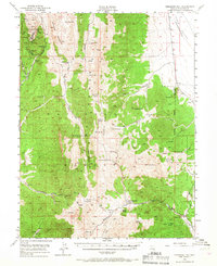
1949 Map of Treasure Hill
USGS Topo · Published 1967About this map
Treasure Hill stands as the focal point of this Nevada mining district, where the topography reveals a landscape heavily shaped by silver-era industry. The map captures the complex network of subterranean mining operations, including the Wheeler Tunnel, Eberhardt Tunnel, and the Stafford Shaft. The settlement of Eberhardt (Site) is noted as a site, indicating the shift from an active camp to a historical marker by the late 1940s.
Find a feature on this map
61 named features on this map. Tap any name to fly to it.
Don’t see what you’re looking for? This feature index may not catch every label — zoom into the map to look around manually.
Map Details
Editions of this 1949 Treasure Hill Map
2 editions found
Other maps of this area

1949 · Treasure Hill
USGS Topo · 1:62,500

1950 · Treasure Hill
USGS Topo · 1:62,500

1951 · Green Springs
USGS Topo · 1:62,500

1951 · Illipah
USGS Topo · 1:62,500

1951 · Pancake Summit
USGS Topo · 1:62,500

1956 · Lund
USGS Topo · 1:250,000

1956 · Ely
USGS Topo · 1:250,000

1957 · Currant Mtn
USGS Topo · 1:62,500

1959 · Ely
USGS Topo · 1:250,000

1959 · Reipetown
USGS Topo · 1:62,500