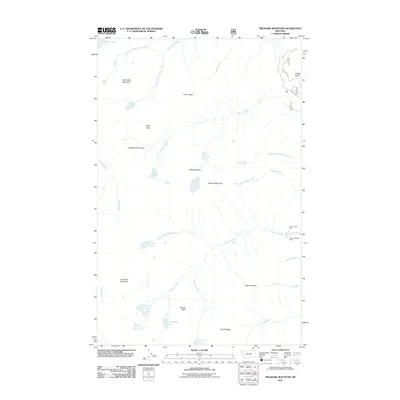
2011 Map of Treasure Mountain
USGS Topo · Published 2011About this map
Treasure Mountain and its surrounding peaks dominate this part of Lincoln County, defining a landscape shaped by glacial action and high-altitude hydrology. The drainage network is complex, with headwaters such as Horse Creek and the South Fork Flower Creek flowing eastward, while Camp Creek and Dry Creek cut through the western terrain. The presence of the Victor-Empire Mine and Silver Mountain Mine near Granite Creek points to the area's mineral prospects, located at the end of the Flower Lake Rd corridor. Dozens of alpine basins hold named waters like Wishbone Lake, Vimy Lake, and Granite Lake, reflecting the geologic character of the Hanging Valley. Significant elevations like Gus Brink Mountain and Sugarloaf Mountain offer a clear record of the region's topography before more modern development.
Find a feature on this map
38 named features on this map. Tap any name to fly to it.
Don’t see what you’re looking for? This feature index may not catch every label — zoom into the map to look around manually.
Map Details
Editions of this 2011 Treasure Mountain Map
This is the sole edition of this map. No revisions or reprints were ever made.
Other maps of this area

1920 · Libby
USGS Topo · 1:125,000

1930 · Libby
USGS Topo · 1:125,000

1932 · Libby
USGS Topo · 1:125,000

1957 · Kalispell
USGS Topo · 1:250,000

1960 · Kalispell
USGS Topo · 1:250,000

1961 · Kalispell
USGS Topo · 1:250,000

1963 · Scenery Mountain
USGS Topo · 1:24,000

1963 · Treasure Mountain
USGS Topo · 1:24,000
1963 · Crowell Mountain
USGS Topo · 1:24,000
1963 · Kootenai Falls
USGS Topo · 1:24,000