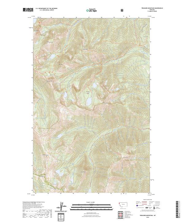
2024 Map of Treasure Mountain
USGS Topo · Published 2024About this map
Cabinet Mountains Wilderness defines the heart of this high-elevation landscape, where deep glacial troughs and sharp ridgelines dominate the terrain. The presence of features like the Hanging Valley and Treasure Mtn highlights the complex geological history of the area. A network of backcountry access points, including the Granite Creek Trl and Indian Head Trl, connects the various peaks and high-altitude water bodies such as Lake Osakis and Crater Lake.
Find a feature on this map
65 named features on this map. Tap any name to fly to it.
Don’t see what you’re looking for? This feature index may not catch every label — zoom into the map to look around manually.
Map Details
Editions of this 2024 Treasure Mountain Map
This is the sole edition of this map. No revisions or reprints were ever made.
Other maps of this area

1920 · Libby
USGS Topo · 1:125,000

1930 · Libby
USGS Topo · 1:125,000

1932 · Libby
USGS Topo · 1:125,000

1957 · Kalispell
USGS Topo · 1:250,000

1960 · Kalispell
USGS Topo · 1:250,000

1961 · Kalispell
USGS Topo · 1:250,000

1963 · Scenery Mountain
USGS Topo · 1:24,000

1963 · Treasure Mountain
USGS Topo · 1:24,000
1963 · Crowell Mountain
USGS Topo · 1:24,000
1963 · Kootenai Falls
USGS Topo · 1:24,000