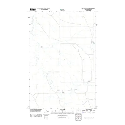
2011 Map of Tree Coulee School
USGS Topo · Published 2011About this map
Tree Coulee School (Historical) stands as a marker of early educational infrastructure in this corner of Garfield County. The terrain is defined by its drainage patterns, with Tree Coulee and Tree Creek cutting through the landscape toward the south, while Beaver Coulee and Crow Rock Creek dominate the central and northern sections. The presence of the Alfred Jordan Number 1 Dam indicates the vital importance of water management in this prairie environment, likely supporting livestock or small-scale agricultural needs. The road network is sparse, centered primarily around Crow Rock Rd, reflecting the low-density settlement pattern typical of rural Montana. This map provides a detailed view of the natural hydrology, including Antelope Cr and Neuhardt Coulee, which shaped the life and movement of early residents in the region.
Find a feature on this map
9 named features on this map. Tap any name to fly to it.
Don’t see what you’re looking for? This feature index may not catch every label — zoom into the map to look around manually.
Map Details
Editions of this 2011 Tree Coulee School Map
This is the sole edition of this map. No revisions or reprints were ever made.
Other maps of this area

1954 · Jordan
USGS Topo · 1:250,000

1954 · Forsyth
USGS Topo · 1:250,000

1956 · Jordan
USGS Topo · 1:250,000

1957 · Forsyth
USGS Topo · 1:250,000

1958 · Jordan
USGS Topo · 1:250,000

1958 · Forsyth
USGS Topo · 1:250,000

1964 · Jordan
USGS Topo · 1:250,000

1965 · Hedstrom Lake
USGS Topo · 1:24,000

1965 · Little Chalk Butte
USGS Topo · 1:24,000

1965 · Hedstrom Lake SE
USGS Topo · 1:24,000