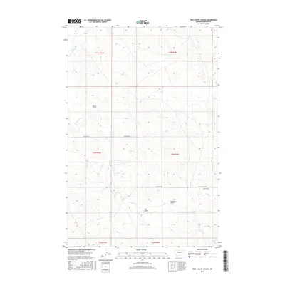
2017 Map of Tree Coulee School
USGS Topo · Published 2017About this map
Tree Coulee School stands as a focal point in this high-plains landscape of Garfield County, marking a localized center for the surrounding ranching community. The terrain is defined by its drainage patterns, with Beaver Coulee and Tree Coulee cutting through the upland pastures. These seasonal watercourses, including Antelope Cr and Tree Cr, dictate the movement and settlement patterns of the region. Transportation is primarily facilitated by Crow Rock Rd, which traverses the landscape from east to west. The map also identifies Neuhardt Coulee, reflecting the family names associated with the local geography. This survey provides a precise view of the Public Land Survey System divisions, showing the boundaries between t16n r43e, t15n r44e, and adjacent townships that structured land ownership in this part of Montana.
Find a feature on this map
14 named features on this map. Tap any name to fly to it.
Don’t see what you’re looking for? This feature index may not catch every label — zoom into the map to look around manually.
Map Details
Editions of this 2017 Tree Coulee School Map
This is the sole edition of this map. No revisions or reprints were ever made.
Other maps of this area

1954 · Jordan
USGS Topo · 1:250,000

1954 · Forsyth
USGS Topo · 1:250,000

1956 · Jordan
USGS Topo · 1:250,000

1957 · Forsyth
USGS Topo · 1:250,000

1958 · Jordan
USGS Topo · 1:250,000

1958 · Forsyth
USGS Topo · 1:250,000

1964 · Jordan
USGS Topo · 1:250,000

1965 · Hedstrom Lake
USGS Topo · 1:24,000

1965 · Little Chalk Butte
USGS Topo · 1:24,000

1965 · Hedstrom Lake SE
USGS Topo · 1:24,000