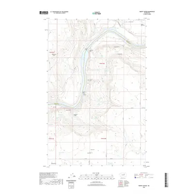
2020 Map of Trefry Canyon
USGS Topo · Published 2020About this map
Rufus Woods Lake dominates the central corridor of this North Central Washington landscape, carving a deep path between the plateaus of Okanogan and Douglas Counties. The canyon-cut terrain is defined by a dense network of springs, including School Section Spring, Negro Spring, and Trefry Springs, which reflect the essential role of water sources in this arid environment. Landforms like Stubblefield Point and Jackass Butte stand as prominent markers above the Columbia River's reservoir, while Trefry Canyon and Phil Canyon provide rugged passage through the breaks. Evidence of ranching and land use appears in the naming of remote areas like Goose Flats and Saddle Horse Flat. The map also captures several family-named landmarks and water sources, such as Walter Sellers Springs and Gordan Sellers Spring, alongside the industrial site at McCabe Oil in the southeastern corner.
Find a feature on this map
57 named features on this map. Tap any name to fly to it.
Don’t see what you’re looking for? This feature index may not catch every label — zoom into the map to look around manually.
Map Details
Editions of this 2020 Trefry Canyon Map
This is the sole edition of this map. No revisions or reprints were ever made.
Other maps of this area

1950 · Boot Mtn
USGS Topo · 1:62,500

1950 · Alameda Flat
USGS Topo · 1:62,500

1952 · Alameda Flat
USGS Topo · 1:62,500

1953 · Ritzville
USGS Topo · 1:250,000

1954 · Okanogan
USGS Topo · 1:250,000

1958 · Okanogan
USGS Topo · 1:250,000

1959 · Ritzville
USGS Topo · 1:250,000

1965 · Ritzville
USGS Topo · 1:250,000

1968 · Barker Canyon
USGS Topo · 1:24,000

1968 · Foster Coulee
USGS Topo · 1:24,000