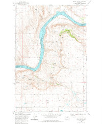
1980 Map of Trefry Canyon
USGS Topo · Published 1981About this map
The Columbia River carves a dramatic bend through this portion of Washington, where the Colville Indian Reservation boundary follows the mid-channel of Rufus Woods Lake. The terrain is characterized by a series of high plateaus and deep drainage cuts, most notably Trefry Canyon and Henderson Canyon. To the east, the small settlement of Del Rio and the Delrio Grange Hall represent the area's agricultural hub, surrounded by family-named landmarks like Pike Spring and Brazel Spring.
Find a feature on this map
48 named features on this map. Tap any name to fly to it.
Don’t see what you’re looking for? This feature index may not catch every label — zoom into the map to look around manually.
Map Details
Editions of this 1980 Trefry Canyon Map
This is the sole edition of this map. No revisions or reprints were ever made.
Other maps of this area

1950 · Boot Mtn
USGS Topo · 1:62,500

1950 · Alameda Flat
USGS Topo · 1:62,500

1952 · Alameda Flat
USGS Topo · 1:62,500

1953 · Ritzville
USGS Topo · 1:250,000

1954 · Okanogan
USGS Topo · 1:250,000

1958 · Okanogan
USGS Topo · 1:250,000

1959 · Ritzville
USGS Topo · 1:250,000

1965 · Ritzville
USGS Topo · 1:250,000

1968 · Barker Canyon
USGS Topo · 1:24,000

1968 · Foster Coulee
USGS Topo · 1:24,000