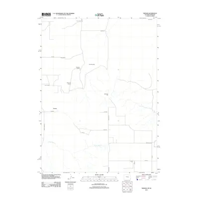
2012 Map of Tremain
USGS Topo · Published 2012About this map
Tremain and its surrounding ranchlands sit along the border of Wyoming and Nebraska in the early 21st century. The landscape is defined by the high plains topography of Laramie County, characterized by drainage systems like Stinking Water Cr and prominent elevations such as Ninemile Hill. This area is dominated by large-scale agricultural operations, evidenced by family-named properties including Tremain Ranch, Johnson Ranch, and Green Ranch. The rural infrastructure is anchored by a grid of county roads, with State Line Rd marking the precise divide between the two states. Genealogy and local history are centered at the Epworth Cem in the southeastern corner of the quadrangle. Significant geologic features, including Ninemile Rock and the intersecting Ninemile Canyon and Wyoming Canyon, provide clear markers for the transition from open grazing land to the breaks and coulees of the high prairie.
Find a feature on this map
23 named features on this map. Tap any name to fly to it.
Don’t see what you’re looking for? This feature index may not catch every label — zoom into the map to look around manually.
Map Details
Editions of this 2012 Tremain Map
This is the sole edition of this map. No revisions or reprints were ever made.
Other maps of this area

1898 · Scotts Bluff
USGS Topo · 1:125,000

1899 · Goshen Hole
USGS Topo · 1:125,000

1954 · Scottsbluff
USGS Topo · 1:250,000

1954 · Cheyenne
USGS Topo · 1:250,000

1958 · Cheyenne
USGS Topo · 1:250,000

1958 · Scottsbluff
USGS Topo · 1:250,000

1960 · Tremain
USGS Topo · 1:24,000

1960 · Mc Compsey Pass
USGS Topo · 1:24,000

1960 · Petsch Reservoir
USGS Topo · 1:24,000

1960 · La Grange
USGS Topo · 1:24,000