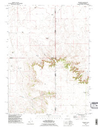
1990 Map of Tremain
USGS Topo · Published 1995About this map
The High Plains ranching landscape of the Wyoming-Nebraska border is documented here during the late 20th century. This area, crossing into Goshen, Laramie, and Banner counties, is defined by long-established family operations including McClure Ranch and Tremain Ranch. The terrain shifts from the level agricultural plateaus where Stinking Water Creek originates to the sharp breaks of Ninemile Canyon and Bull Canyon. Evidence of rural community life is centered at the Epworth Cem in the south, while the small settlement at Tremain and various landmarks like Ninemile Rock provide navigational anchors in this open country. A subterranean Pipeline and a modern Communication Tower indicate the integration of industrial infrastructure into this traditional cattle-ranching territory.
Find a feature on this map
22 named features on this map. Tap any name to fly to it.
Don’t see what you’re looking for? This feature index may not catch every label — zoom into the map to look around manually.
Map Details
Editions of this 1990 Tremain Map
This is the sole edition of this map. No revisions or reprints were ever made.
Other maps of this area

1898 · Scotts Bluff
USGS Topo · 1:125,000

1899 · Goshen Hole
USGS Topo · 1:125,000

1954 · Scottsbluff
USGS Topo · 1:250,000

1954 · Cheyenne
USGS Topo · 1:250,000

1958 · Cheyenne
USGS Topo · 1:250,000

1958 · Scottsbluff
USGS Topo · 1:250,000

1960 · Tremain
USGS Topo · 1:24,000

1960 · Mc Compsey Pass
USGS Topo · 1:24,000

1960 · Petsch Reservoir
USGS Topo · 1:24,000

1960 · La Grange
USGS Topo · 1:24,000