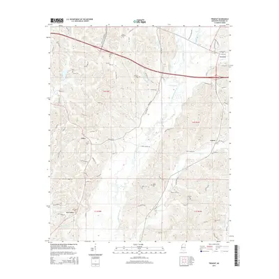
2015 Map of Tremont
USGS Topo · Published 2015About this map
Tremont and the surrounding rural landscape of eastern Itawamba County are defined by a network of creeks and small settlements in this 2015 record. The drainage of Bull Mountain Creek dominates the central terrain, fed by tributaries like Lick Skillet Cr and Jims Cr. This map is particularly valuable for genealogists, as it preserves the locations of numerous family and community burial grounds, including Old Mount Pisgah Cem and Moore Cem. The transition from the more established community of Tremont to the rural hamlets of Tilden and Cadamy reveals the persistent agricultural and timber-driven character of the region. Local infrastructure is shown through a mix of modern corridors like Appalachian Corridor X and historical local routes such as Old White Springs Rd, illustrating the evolution of transport in this corner of Mississippi.
Find a feature on this map
76 named features on this map. Tap any name to fly to it.
Don’t see what you’re looking for? This feature index may not catch every label — zoom into the map to look around manually.
Map Details
Editions of this 2015 Tremont Map
This is the sole edition of this map. No revisions or reprints were ever made.
Other maps of this area

1956 · Tupelo
USGS Topo · 1:250,000

1958 · Tupelo
USGS Topo · 1:250,000

1965 · Fulton SE
USGS Topo · 1:24,000

1965 · Fulton
USGS Topo · 1:24,000

1966 · Smithville
USGS Topo · 1:24,000

1966 · Beans Ferry
USGS Topo · 1:24,000

1966 · Turon
USGS Topo · 1:24,000

1966 · Tremont
USGS Topo · 1:24,000
1967 · Shottsville
USGS Topo · 1:24,000
1967 · Bexar
USGS Topo · 1:24,000