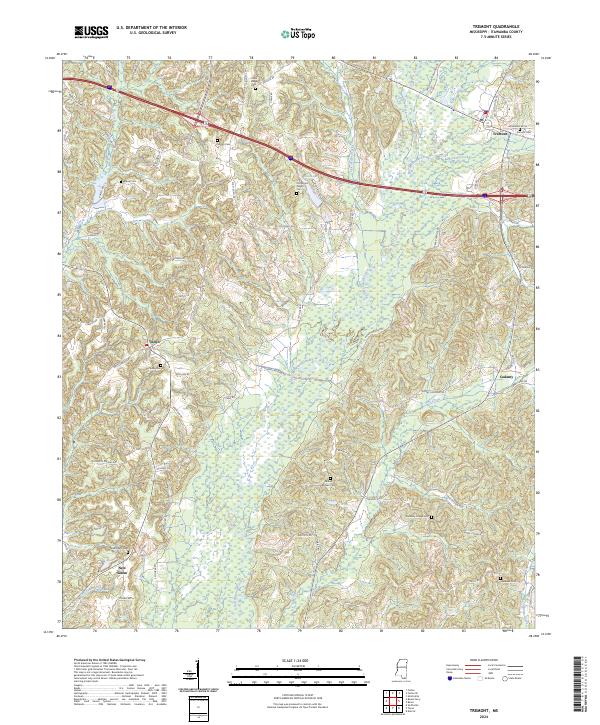
2024 Map of Tremont
USGS Topo · Published 2024About this map
Bull Mountain Creek and its many tributaries, including Lick Skillet Creek, Gum Creek, and Cypress Creek, define the topography of this corner of eastern Itawamba County. The landscape is primarily a network of rural roads and watercourses, with the larger town of Tremont situated in the northeast. This area remains dotted with small family and community anchors, particularly in the form of numerous burial grounds like the Old Mount Pisgah Cem and Clover Ridge Cem. The transition from the higher ground near Bull Mtn down toward the creek valleys creates a complex drainage pattern that has historically influenced the placement of early settlements such as Tilden, Cadamy, and New Salem. A modern transportation corridor now cuts across the northern section, bypassing many of the older road networks like Old Cotton Gin Rd and Horns Crossing Rd.
Find a feature on this map
76 named features on this map. Tap any name to fly to it.
Don’t see what you’re looking for? This feature index may not catch every label — zoom into the map to look around manually.
Map Details
Editions of this 2024 Tremont Map
This is the sole edition of this map. No revisions or reprints were ever made.
Other maps of this area

1956 · Tupelo
USGS Topo · 1:250,000

1958 · Tupelo
USGS Topo · 1:250,000

1965 · Fulton SE
USGS Topo · 1:24,000

1965 · Fulton
USGS Topo · 1:24,000

1966 · Smithville
USGS Topo · 1:24,000

1966 · Beans Ferry
USGS Topo · 1:24,000

1966 · Turon
USGS Topo · 1:24,000

1966 · Tremont
USGS Topo · 1:24,000
1967 · Shottsville
USGS Topo · 1:24,000
1967 · Bexar
USGS Topo · 1:24,000