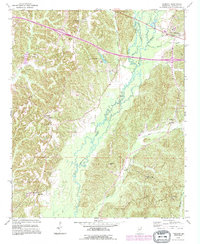
1992 Map of Tremont
USGS Topo · Published 1995About this map
Tremont sits at a critical junction in eastern Itawamba County, where the meandering course of Bull Mountain Creek and its many tributaries like Lick Skillet Creek and Hickory Creek define the landscape. This 1992 revision reveals a community structured by its rural institutions, with numerous family and church burial sites such as Old Mt Pisgah Cem and Clover Ridge Cem dotting the ridges. The settlement pattern follows the high ground above the creek bottoms, connecting Tilden and Cadamy via a network of local roads and highways. Evidence of resource extraction appears in the form of several Gas Wells and Gravel Pits, while local spiritual life is anchored by landmarks like Mt Pisgah Ch and Kennedy Chapel. The gaging station on Bull Mountain Creek underscores the importance of monitoring the complex hydrology of this drainage basin.
Find a feature on this map
32 named features on this map. Tap any name to fly to it.
Don’t see what you’re looking for? This feature index may not catch every label — zoom into the map to look around manually.
Map Details
Editions of this 1992 Tremont Map
This is the sole edition of this map. No revisions or reprints were ever made.
Other maps of this area

1956 · Tupelo
USGS Topo · 1:250,000

1958 · Tupelo
USGS Topo · 1:250,000

1965 · Fulton SE
USGS Topo · 1:24,000

1965 · Fulton
USGS Topo · 1:24,000

1966 · Smithville
USGS Topo · 1:24,000

1966 · Beans Ferry
USGS Topo · 1:24,000

1966 · Turon
USGS Topo · 1:24,000

1966 · Tremont
USGS Topo · 1:24,000
1967 · Shottsville
USGS Topo · 1:24,000
1967 · Bexar
USGS Topo · 1:24,000