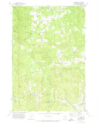
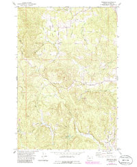
1971 Map of Trenholm
USGS Topo · Published 1974About this map
Milton Creek and its numerous tributaries, including Apitton Creek and Salmonberry Creek, carve through the upland timber country of Columbia County in this early 1970s survey. The landscape is defined by its drainage networks and small rural clusters like Trenholm and Canaan, which reflect the region's historical reliance on logging and small-scale agriculture. Towards the north, the terrain transitions toward the drainage of Goble Creek and the settlement of Beaver Homes. These maps are particularly useful for tracing the old road networks such as Fairview Road and identifying family-named landmarks like Serafin Point. The intricate detail of the creeks, including the Little Clatskanie River and Merrill Creek, provides a clear view of the rural topography before modern development altered these traditional boundaries.
Find a feature on this map
17 named features on this map. Tap any name to fly to it.
Don’t see what you’re looking for? This feature index may not catch every label — zoom into the map to look around manually.
Map Details
Editions of this 1971 Trenholm Map
2 editions found
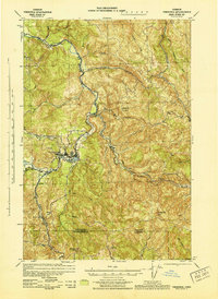
Other maps of this area

1919 · Mayger
USGS Topo · 1:62,500

1921 · Kalama
USGS Topo · 1:62,500

1922 · St. Helens
USGS Topo · 1:62,500

1940 · Vernonia
USGS Topo · 1:62,500

1941 · St Helens
USGS Topo · 1:62,500

1941 · Clatskanie
USGS Topo · 1:62,500
1943 · Vernonia
USGS Topo · 1:62,500

1943 · St Helens
USGS Topo · 1:62,500

1948 · Vancouver
USGS Topo · 1:250,000

1950 · Vancouver
USGS Topo · 1:250,000