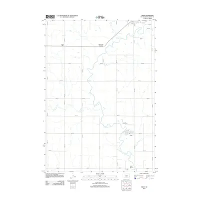
2012 Map of Trent
USGS Topo · Published 2012About this map
The Big Sioux River meanders through this portion of Moody County, defining the agricultural landscape around the small settlement of Trent. The terrain is characterized by the river's extensive floodplain and its various tributaries, including Bachelor Cr and Squaw Cr. One of the most significant landmarks is the Trent Mounds, a distinctive topographic and archaeological feature situated near the riverbanks.
Find a feature on this map
32 named features on this map. Tap any name to fly to it.
Don’t see what you’re looking for? This feature index may not catch every label — zoom into the map to look around manually.
Map Details
Editions of this 2012 Trent Map
This is the sole edition of this map. No revisions or reprints were ever made.
Other maps of this area

1953 · Watertown
USGS Topo · 1:250,000

1955 · Sioux Falls
USGS Topo · 1:250,000

1958 · Sioux Falls
USGS Topo · 1:250,000

1958 · Watertown
USGS Topo · 1:250,000

1962 · Colton SE
USGS Topo · 1:24,000

1962 · Dell Rapids
USGS Topo · 1:24,000

1963 · Trent
USGS Topo · 1:24,000

1963 · Colman
USGS Topo · 1:24,000

1964 · Rutland SE
USGS Topo · 1:24,000

1964 · Flandreau SW
USGS Topo · 1:24,000