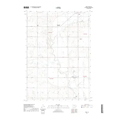
2017 Map of Trent
USGS Topo · Published 2017About this map
The Big Sioux River meanders through this landscape in Moody County, defining the agricultural and historical character of the region. The town of Trent sits near the river's edge, surrounded by local landmarks including the Trent Sunnyside Cem and the Riverview Cem. Further south, the Trent Mounds offer a rare glimpse into the ancient indigenous history of the plains, while the small settlement of Egan anchors the northern reaches of the quadrangle.
Find a feature on this map
45 named features on this map. Tap any name to fly to it.
Don’t see what you’re looking for? This feature index may not catch every label — zoom into the map to look around manually.
Map Details
Editions of this 2017 Trent Map
This is the sole edition of this map. No revisions or reprints were ever made.
Other maps of this area

1953 · Watertown
USGS Topo · 1:250,000

1955 · Sioux Falls
USGS Topo · 1:250,000

1958 · Sioux Falls
USGS Topo · 1:250,000

1958 · Watertown
USGS Topo · 1:250,000

1962 · Colton SE
USGS Topo · 1:24,000

1962 · Dell Rapids
USGS Topo · 1:24,000

1963 · Trent
USGS Topo · 1:24,000

1963 · Colman
USGS Topo · 1:24,000

1964 · Rutland SE
USGS Topo · 1:24,000

1964 · Flandreau SW
USGS Topo · 1:24,000