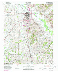
1951 Map of Trenton
USGS Topo · Published 1981About this map
The North Fork Forked Deer River defines the upper landscape of this Gibson County region, where the town of Trenton serves as a primary hub for commerce and transportation. The map reflects a mid-century rural economy transitioning toward modern infrastructure, with the Illinois Central Gulf railroad and several state routes intersecting near the town center. Cultural markers of the era are visible in the local Drive-in Theater and the County Farm.
Find a feature on this map
34 named features on this map. Tap any name to fly to it.
Don’t see what you’re looking for? This feature index may not catch every label — zoom into the map to look around manually.
Map Details
Editions of this 1951 Trenton Map
2 editions found
Other maps of this area

1951 · Trenton
USGS Topo · 1:24,000

1952 · Milan
USGS Topo · 1:24,000

1953 · Dyer
USGS Topo · 1:24,000

1954 · Bradford
USGS Topo · 1:24,000

1956 · Dyersburg
USGS Topo · 1:250,000

1956 · Blytheville
USGS Topo · 1:250,000

1959 · Medina
USGS Topo · 1:24,000

1959 · Blytheville
USGS Topo · 1:250,000

1959 · Humboldt
USGS Topo · 1:24,000
1964 · Alamo
USGS Topo · 1:24,000