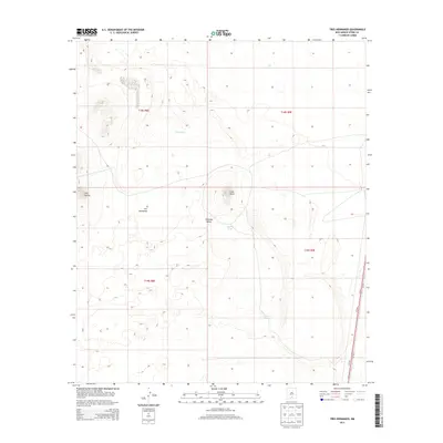
2013 Map of Tres Hermanos
USGS Topo · Published 2013About this map
Tularosa Valley defines this arid landscape in southern New Mexico, where water management is the primary marker of human presence. Named catchments such as Flat Tank, North Tank, Squaw Tank, and Desert Tank are scattered across the terrain, indicating the importance of livestock and range management in this high-desert environment. The topography is punctuated by prominent rises, most notably Lone Butte and the Twin Buttes located on the western edge of the quadrangle. The settlement of Tres Hermanos sits near the center of the sheet, while the transportation corridor of Us-54 N and Us-54 S runs along the eastern boundary, providing the main arterial connection through Otero County. The land is strictly organized by the Public Land Survey System, as evidenced by the grid of t18s r8e, t18s r9e, t19s r8e, and t19s r9e.
Find a feature on this map
14 named features on this map. Tap any name to fly to it.
Don’t see what you’re looking for? This feature index may not catch every label — zoom into the map to look around manually.
Map Details
Editions of this 2013 Tres Hermanos Map
This is the sole edition of this map. No revisions or reprints were ever made.
Other maps of this area

1916 · Point Of Sands
USGS Topo · 1:125,000

1948 · Tres Hermanos
USGS Topo · 1:62,500

1948 · Holloman
USGS Topo · 1:62,500

1950 · Escondido Canyon
USGS Topo · 1:62,500

1950 · Alamogordo
USGS Topo · 1:62,500

1954 · Carlsbad
USGS Topo · 1:250,000

1955 · Las Cruces
USGS Topo · 1:250,000

1958 · Las Cruces
USGS Topo · 1:250,000

1958 · Carlsbad
USGS Topo · 1:250,000

1976 · Mule Peak
USGS Topo · 1:24,000