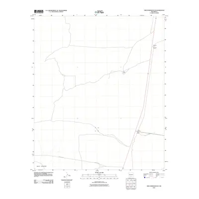
2010 Map of Tres Hermanos SE
USGS Topo · Published 2010About this map
The arid landscape of Otero County is defined by the southeastern reaches of the Jarilla Mountains and the sparse infrastructure of the New Mexican desert. The movement of people and goods through this region is marked by a north-south rail corridor, featuring specific infrastructure such as Escondida Siding and Paxton Siding, alongside their corresponding crossings. These rail points served as vital logistical nodes in an otherwise open terrain. Settlement is represented by Olden Ranch, which sits isolated between the mountains and the railway. The transportation network is further anchored by County RD-A011, providing a glimpse into the connectivity of the high desert at the start of the twenty-first century.
Find a feature on this map
8 named features on this map. Tap any name to fly to it.
Don’t see what you’re looking for? This feature index may not catch every label — zoom into the map to look around manually.
Map Details
Editions of this 2010 Tres Hermanos SE Map
This is the sole edition of this map. No revisions or reprints were ever made.
Other maps of this area

1916 · Point Of Sands
USGS Topo · 1:125,000

1940 · Orogrande
USGS Topo · 1:62,500

1943 · Pendejo Wash
USGS Topo · 1:62,500

1943 · Orogrande
USGS Topo · 1:62,500

1947 · Orogrande North
USGS Topo · 1:24,000

1948 · Elephant Mountain
USGS Topo · 1:24,000

1948 · Tres Hermanos
USGS Topo · 1:62,500

1950 · Escondido Canyon
USGS Topo · 1:62,500

1954 · Carlsbad
USGS Topo · 1:250,000
1955 · Elephant Mountain
USGS Topo · 1:24,000