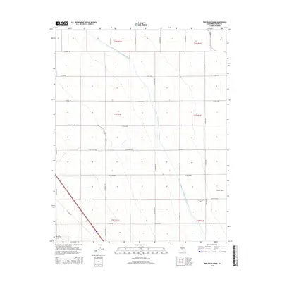
2015 Map of Tres Picos Farms
USGS Topo · Published 2015About this map
Tres Picos Farms sits within the heart of the San Joaquin Valley, characterized by the massive agricultural engineering of the Governor Edmund G. Brown California Aqueduct. This 2015 survey illustrates the precision of modern California water management, where the aqueduct cuts a linear path across the landscape to support the region's vast farming operations. The map details a strictly organized grid of rural roads and section lines, including W Whitney Ave and S Stanislaus Ave, which define the agricultural blocks typical of Fresno County. The seasonal flow of Cantua Creek provides a natural contrast to the industrial scale of the nearby irrigation infrastructure, offering a clear view of how water dictates the settlement patterns and land use in this part of the Central Valley.
Find a feature on this map
1 named feature on this map. Tap any name to fly to it.
Don’t see what you’re looking for? This feature index may not catch every label — zoom into the map to look around manually.
Map Details
Editions of this 2015 Tres Picos Farms Map
This is the sole edition of this map. No revisions or reprints were ever made.
Other maps of this area

1912 · Coalinga
USGS Topo · 1:125,000

1923 · Levis
USGS Topo · 1:31,680

1923 · Englebrecht Ranch
USGS Topo · 1:31,680

1925 · San Joaquin
USGS Topo · 1:31,680

1928 · Delta Farms No 3
USGS Topo · 1:31,680

1931 · Towne Oil Station
USGS Topo · 1:31,680

1931 · Mouth of Cantua Creek
USGS Topo · 1:31,680

1932 · Delta Farms
USGS Topo · 1:31,680

1943 · Joaquin Rocks
USGS Topo · 1:62,500

1946 · Tranquillity
USGS Topo · 1:62,500