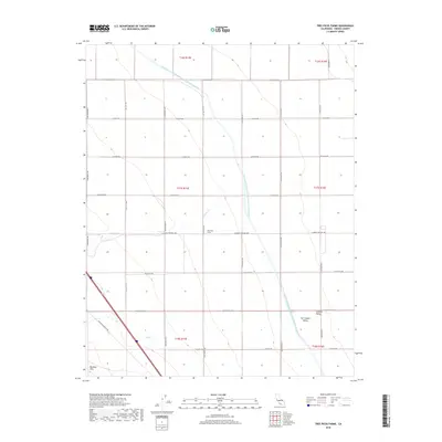
2018 Map of Tres Picos Farms
USGS Topo · Published 2018About this map
Tres Picos Farms sits within a landscape defined by industrial-scale agriculture and critical water infrastructure in the heart of the San Joaquin Valley. This portion of the Central Valley is bisected by the massive Governor Edmund G Brown California Aqueduct, which winds southward across a grid of section lines and gravel access roads. The terrain transitions from the flat alluvial floor toward the rising slopes of the Big Blue Hills in the southwest, where the Coalinga-Mendota Rd provides a primary transit corridor alongside seasonal watercourses like Cantua Cr and Salt Cr. The map reveals a strictly organized rural geography, where family-named thoroughfares such as S Amador Rd and S Tuolumne Ave serve the expansive farm plots and orchards that dominate the region's economy.
Find a feature on this map
30 named features on this map. Tap any name to fly to it.
Don’t see what you’re looking for? This feature index may not catch every label — zoom into the map to look around manually.
Map Details
Editions of this 2018 Tres Picos Farms Map
This is the sole edition of this map. No revisions or reprints were ever made.
Other maps of this area

1912 · Coalinga
USGS Topo · 1:125,000

1923 · Levis
USGS Topo · 1:31,680

1923 · Englebrecht Ranch
USGS Topo · 1:31,680

1925 · San Joaquin
USGS Topo · 1:31,680

1928 · Delta Farms No 3
USGS Topo · 1:31,680

1931 · Towne Oil Station
USGS Topo · 1:31,680

1931 · Mouth of Cantua Creek
USGS Topo · 1:31,680

1932 · Delta Farms
USGS Topo · 1:31,680

1943 · Joaquin Rocks
USGS Topo · 1:62,500

1946 · Tranquillity
USGS Topo · 1:62,500