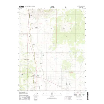
2017 Map of Tres Piedras
USGS Topo · Published 2017About this map
Tres Piedras sits at a geographic crossroads where the sagebrush plains meet the rising eastern slopes of the Carson National Forest. The settlement is defined by its proximity to the Tres Piedras Arroyo and the nearby Tres Piedras Canyon, markers of a landscape shaped by seasonal water flow. To the north, the terrain transitions into more prominent volcanic features, including the No Agua Peaks and the high summit of Cerro del Aire.
Find a feature on this map
35 named features on this map. Tap any name to fly to it.
Don’t see what you’re looking for? This feature index may not catch every label — zoom into the map to look around manually.
Map Details
Editions of this 2017 Tres Piedras Map
This is the sole edition of this map. No revisions or reprints were ever made.
Other maps of this area

1918 · Tusas
USGS Topo · 1:125,000

1954 · Raton
USGS Topo · 1:250,000

1954 · Aztec
USGS Topo · 1:250,000

1958 · Raton
USGS Topo · 1:250,000

1958 · Aztec
USGS Topo · 1:250,000

1962 · Aztec
USGS Topo · 1:250,000
1963 · Las Tablas
USGS Topo · 1:24,000

1963 · Tres Piedras NE
USGS Topo · 1:24,000

1963 · Cerro De La Olla
USGS Topo · 1:24,000

1963 · Cerro De Los Taoses
USGS Topo · 1:24,000