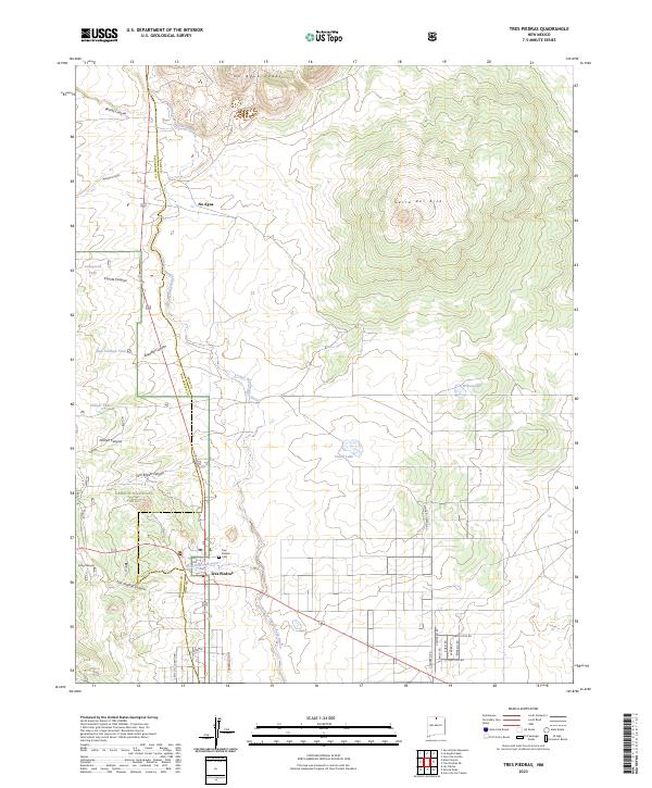
2023 Map of Tres Piedras
USGS Topo · Published 2023About this map
Tres Piedras sits at the high-altitude junction of public and protected lands, where the high desert plateau meets the southern reaches of the San Juan Mountains. This contemporary survey captures the settlement near the northern boundary of the Carson National Forest and the southern edge of the Rio Grande del Norte National Monument. The terrain is defined by prominent volcanic features like Cerro del Aire and the No Agua Peaks, which rise above a network of seasonal watercourses and drainage channels such as Arroyo Aguaje de la Petaca. Genealogists and local historians can locate the Tres Piedras Cem and trace the small community of No Agua. The map also details numerous cattle tanks and small lakes, including Wilson Lake and Cissell Lake, reflecting the region's long-standing reliance on water management for ranching and forest operations.
Find a feature on this map
39 named features on this map. Tap any name to fly to it.
Don’t see what you’re looking for? This feature index may not catch every label — zoom into the map to look around manually.
Map Details
Editions of this 2023 Tres Piedras Map
This is the sole edition of this map. No revisions or reprints were ever made.
Other maps of this area

1918 · Tusas
USGS Topo · 1:125,000

1954 · Raton
USGS Topo · 1:250,000

1954 · Aztec
USGS Topo · 1:250,000

1958 · Raton
USGS Topo · 1:250,000

1958 · Aztec
USGS Topo · 1:250,000

1962 · Aztec
USGS Topo · 1:250,000
1963 · Las Tablas
USGS Topo · 1:24,000

1963 · Tres Piedras NE
USGS Topo · 1:24,000

1963 · Cerro De La Olla
USGS Topo · 1:24,000

1963 · Cerro De Los Taoses
USGS Topo · 1:24,000