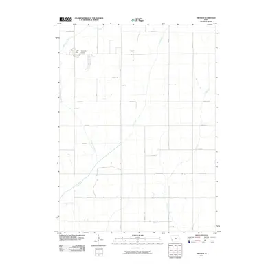
2010 Map of Treynor
USGS Topo · Published 2010About this map
Treynor serves as the primary hub in this Pottawattamie County landscape, where the town's grid meets the surrounding agricultural section lines. The settlement is centered around local services like the Treynor Post Office and the Treynor Zion Congregational Cemetery, which sits just northeast of the main town site. This area is characterized by a significant drainage system flowing generally southward, defined by the winding paths of Silver Creek, Little Silver Creek, and Middle Silver Creek, with Mud Creek cutting through the eastern portions of the quadrangle.
Find a feature on this map
26 named features on this map. Tap any name to fly to it.
Don’t see what you’re looking for? This feature index may not catch every label — zoom into the map to look around manually.
Map Details
Editions of this 2010 Treynor Map
This is the sole edition of this map. No revisions or reprints were ever made.
Other maps of this area

1954 · Omaha
USGS Topo · 1:250,000

1956 · Glenwood
USGS Topo · 1:24,000

1956 · Mineola
USGS Topo · 1:24,000

1956 · Treynor
USGS Topo · 1:24,000

1956 · Mc Clelland
USGS Topo · 1:24,000

1956 · Malvern
USGS Topo · 1:24,000

1957 · Omaha
USGS Topo · 1:250,000

1957 · Taylor
USGS Topo · 1:24,000

1958 · Omaha
USGS Topo · 1:250,000

1963 · Oakland
USGS Topo · 1:24,000