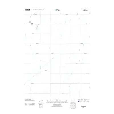
2013 Map of Treynor
USGS Topo · Published 2013About this map
Treynor serves as the primary residential hub in this western Iowa landscape, where the street grid is clearly defined by local roads like Holst St and Park St. This 2013 survey by the U.S. Geological Survey captures the town's expansion through newer developments such as Countryside Dr and Lamar Dr. The surrounding geography is defined by a series of north-south drainage patterns, most notably Silver Cr and its tributaries, Middle Silver Cr and Little Silver Cr. These waterways cut through the section lines of the agricultural grid, which is strictly organized by rural routes such as Pioneer Trl and Cottonwood Rd. The map illustrates the characteristic Iowa settlement pattern where residential centers are concentrated along major thoroughfares while the broader territory remains dedicated to the precise geometry of farm sections and creek valleys like Mud Cr.
Find a feature on this map
30 named features on this map. Tap any name to fly to it.
Don’t see what you’re looking for? This feature index may not catch every label — zoom into the map to look around manually.
Map Details
Editions of this 2013 Treynor Map
This is the sole edition of this map. No revisions or reprints were ever made.
Other maps of this area

1954 · Omaha
USGS Topo · 1:250,000

1956 · Glenwood
USGS Topo · 1:24,000

1956 · Mineola
USGS Topo · 1:24,000

1956 · Treynor
USGS Topo · 1:24,000

1956 · Mc Clelland
USGS Topo · 1:24,000

1956 · Malvern
USGS Topo · 1:24,000

1957 · Omaha
USGS Topo · 1:250,000

1957 · Taylor
USGS Topo · 1:24,000

1958 · Omaha
USGS Topo · 1:250,000

1963 · Oakland
USGS Topo · 1:24,000