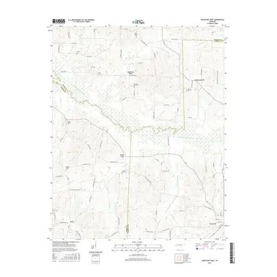
2016 Map of Trezevant West
USGS Topo · Published 2016About this map
The South Fork Obion River carves a significant wetland corridor through the heart of this West Tennessee landscape, marking the tri-county junction where Weakley, Gibson, and Carroll counties meet. This rural topography is defined by small, dispersed communities and historically significant landing points such as Staffords Store and Christmasville. The area's social fabric is visible through its many country burying grounds, including Pilgrims Rest Cem, Pleasant Green Cem, and Belews Chapel Cem, often situated near small drainage branches like Thompson Cr or DeMoss Cr. In the southern reaches, the town of Trezevant appears as the primary population center, with its street grid including Broad St S and Atwood St providing a clear transition from the surrounding creek bottoms and agricultural woodlots.
Find a feature on this map
80 named features on this map. Tap any name to fly to it.
Don’t see what you’re looking for? This feature index may not catch every label — zoom into the map to look around manually.
Map Details
Editions of this 2016 Trezevant West Map
This is the sole edition of this map. No revisions or reprints were ever made.
Other maps of this area

1952 · Milan
USGS Topo · 1:24,000

1954 · Greenfield
USGS Topo · 1:24,000

1954 · Bradford
USGS Topo · 1:24,000

1956 · Dyersburg
USGS Topo · 1:250,000

1956 · Blytheville
USGS Topo · 1:250,000

1959 · Blytheville
USGS Topo · 1:250,000

1966 · Mc Lemoresville
USGS Topo · 1:24,000

1966 · Atwood
USGS Topo · 1:24,000

1966 · Trezevant West
USGS Topo · 1:24,000

1967 · Pillowville
USGS Topo · 1:24,000