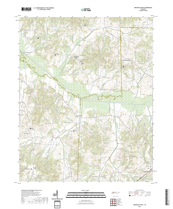
2022 Map of Trezevant West
USGS Topo · Published 2022About this map
The South Fork Obion River meanders across this West Tennessee landscape, forming the natural border between Weakley and Gibson counties before turning east into Carroll. The area is defined by a dense network of country roads and small, family-centric settlements that highlight the rural character of the region. Trezevant anchors the southeast corner, where local streets like W Main St and Broad St S intersect near the railroad corridor. The map preserves several small communities and trading points, including Christmasville, Holly Leaf, and Staffords Store. Numerous burial sites, such as the Bland Family Cem and Mount Pleasant Cem, are scattered throughout the hills and creek bottoms, serving as vital landmarks for genealogists and local historians documenting the family legacies of the area near Thompson Cr and DeMoss Cr.
Find a feature on this map
81 named features on this map. Tap any name to fly to it.
Don’t see what you’re looking for? This feature index may not catch every label — zoom into the map to look around manually.
Map Details
Editions of this 2022 Trezevant West Map
This is the sole edition of this map. No revisions or reprints were ever made.
Other maps of this area

1952 · Milan
USGS Topo · 1:24,000

1954 · Greenfield
USGS Topo · 1:24,000

1954 · Bradford
USGS Topo · 1:24,000

1956 · Dyersburg
USGS Topo · 1:250,000

1956 · Blytheville
USGS Topo · 1:250,000

1959 · Blytheville
USGS Topo · 1:250,000

1966 · Mc Lemoresville
USGS Topo · 1:24,000

1966 · Atwood
USGS Topo · 1:24,000

1966 · Trezevant West
USGS Topo · 1:24,000

1967 · Pillowville
USGS Topo · 1:24,000